Homeward: Anchorage and Vancouver

June 29th, 2005 | 16:55

The previous entry is Denali part two.

June 11, June 12

In Anchorage, we said good-bye to Tour 21. We’d later bump into people from the tour at the airport — there are only so many flights leaving Anchorage on a given day — but we were on our own now, with Holland America’s guidance now in the past. After we got our luggage out of the bellhop station and found that our bag from Fairbanks had arrived safely, we went out for a little walk and dinner, picking up last minute souveniers and getting the next Stephen King book (I had copies at home, but wanted to read it on the plane; I’d later sell this copy to a used book store in Cleveland). There’s another big brewery/restaurant in downtown Anchorage, the Snow Goose, but we didn’t find the food (or root beer) as good as the Glacier Brewhouse the week before. The Snow Goose has a better view overlooking Anchorage harbor, but that’s about it, and it was raining.

Breakfast was at a diner near the camera store where we got the step-down ring from the week earlier. There was a little note in the menu saying they had Wi-Fi, but we didn’t have the laptop and there were no visible outlets. The food was good, far better than the slim selections at this coffee store across the street from the convention center that we sort of ate at before departing for Prudhoe Bay. I suppose we figuring out downtown Anchorage stores in glimpses, before departing.

We caught an earlier shuttle to the airport, which was a good thing: Anchorage’s Race for the Cure (at least we thought so from the pink ribbons) blocked traffic near the hotel for a good hour. For some reason, hotel security wound up directing traffic — getting cars to turn back before the backup got worse — instead of Anchorage police. There were police cruisers on the intersection for the Race route, but they just sat there and waved at the runners. Where were the roadblocks a block or two away so that cars and buses wouldn’t get into an impenetrable cul-de-sac? Useless.

anchorage airport

The flight itself was fine, and we passed through Vancouver’s customs without incident. There wasn’t a line at all, so I suppose the idea would be to arrive after 4 or 5PM, as all the people going on cruises would have already passed through at that point. The customs officials are probably on a shift schedule, and they seem to be at peak staffing for a few hours after their busy period.

We stayed at the Hyatt again, using up the second voucher from the frequent flyer miles. There was another gaggle of prom goers in tuxes and pink ball gowns in the lobby. The elevators were now locked down to room key holders, so perhaps a previous prom group caused havoc in the hotel over the previous weekend or so. We didn’t have a balcony on the new room, but the view looked directly north to the harbor. For the first time in over a week, we saw real nightfall, at a reasonable (though late) hour.

For our second Vancouver dinner, we ate at C Restaurant, on the recommendation of one of our cruise dining table partners, something about amazing halibut. Unlike Lumiere, this was within walking distance, and on the water at the southern side of the pennisula. Mainly a seafood restaurant, we did the standard usual appetizer-entree-dessert; they had a tasting menu, but we were too tired and had to get up too early to try it. The food was very good, and maybe we’ll go there again when we’re back in Vancouver: it’d be a nicer experience with warmer weather, as the restaurant overlooks the marina. The walk to and from the restaurant was also very nice, as we got to see a little of residential Vancouver, walking between the apartment towers, and one of the lively commercial streets, filled with sushi restaurants, bookstores and coffee shops. It’s a nice town, built for walking, something we hadn’t done in a while.

On the way to the restaurant, we saw a skunk wandering around in the bushes next to an Olive Garden-y Italian restaurant. One of the restaurant employees was watching it, making sure it didn’t wander too close to the entrance, though I’m not sure what he’d do if the skunk tried. I’m not sure how the skunk got there — it must have crossed a number of busy streets to get where it was — but we weren’t that interested to find out. We should have gone back that way, just to see if we could smell what happened.

There was a bit of a hassle to check into the flight — we had a lot of luggage, there didn’t seem to be a way to print boarding passes, and Continental had stuck us on different flights out of Minneapolis — but it was fairly smooth after the airline service desk. Immigration was in Vancouver, before boarding US flights, and was a breeze, again possibly because of coincident timing. Minneapolis took a while to transfer through, with a long walk to get to the tram, and another long walk afterwards, but our flight was delayed. At least the immigration portion had already been taken care of.

Soon after landing at Cleveland-Hopkins, we caught a cab and got home, tired, but with a lot of pictures to show people and stories to tell.

Denali II

June 29th, 2005 | 15:16

The previous entry is Denali part one.

June 10

One of the stories Judith told us on the long bus ride down from Prudhoe Bay was about the time she flew on one of the flightseeing tours with a friend of hers to see Mt. McKinley (also called Denali, its Native American name; I’ll use the two names interchangably). It was a clear day, so the mountain was visible from far away. “How close are we getting?” “Pretty close.” As the plane flew down the valley near the mountain, Judith said Denali loomed ever larger over the plane, and she involuntarily leaned further and further away from the window. The pilot asked, “Close enough for you?” Yep. They were still about three miles from the slope. On the train ride from Fairbanks to Denali, a Holland America sales person came around selling the various excursions available from the McKinley Village hotel. After hearing the story, we signed up for only one, the flightseeing tour to the mountain.

A shuttle picked us up early in the morning and took us to the local airport. There, we were given a short lecture over a 3-dimensional model of area of the park we were going to fly over, telling us where we’d go, what we’d probably see (weather permitting: at any given time there are several distinct weather systems over Denali), what these formations are. Mt. McKinley dominated this topological model as it dominates the real landscape. We heard a little bit of history: the first climbers of Denali came from the north, taking a great deal of time to cross a group of rivers before being able to set up a basecamp to begin their ascent. The side they attempted has one of the great sheer walls in the world, a mile or two high. McKinley has two peaks, in fact, and these climbers summited on the shorter, closer one: they didn’t see the farther one because of the clouds until they got to the top.

The guide pointed to a larger glacial formation to the southwest of the mountain and noted that modern climbers set up basecamp on the glacier and ascend Denali from there. The climb now takes a couple of weeks instead of a couple of months, in large part because they don’t have to schlepp all their gear across a wide flood plain. (The guide didn’t know why the original climbers didn’t come from this direction. I suspect this route becomes feasible after the introduction of helicopters or other aircraft that can make a glacier landing. Also, all the logistics, i.e., roads and railheads, may be to the north of the mountain.) We might see climbers trudging along the glacier, weather permitting.

The guide left, and we were introduced to the pilots. Half the group — there were people from a different tour; from Tour 21, there was only one other couple for that time slot — went off and our pilot gave a quick “here’s where we’re going” talk over the map. Then we headed outside behind the building to the runway. Our plane was a two-engine, seven-seater for the six of us (including the pilot; there was an older woman there, too). If you believes commercial jets have narrow aisles and small seats, then you haven’t been aboard this sort of plane: it was cramped, but we all had window seats.

I should be a better editor and trim down the photos — we took a lot –but there was a certain awe and wonder as we soared around Denali, snow-capped peaks to our side or below us. We went a bit nuts with the cameras, snapping almost continuously for the 90-minute flight, trying to capture what we were seeing. At times, a shaft of sunlight would fill the cabin and the glare reflected from our jackets would fill the windows, detracting from the shots. (Perhaps someone with strong PhotoShop/GIMP kung fu will remove this glare in the future.) I should be a better editor and restrict the shots to the most interesting ones, but I find them all interesting: it’s a little of what we experienced when we were in the sky.

Denali

The first part of the flight was above the plains and valleys that we drove through on the bus the day before, the characteristic braided river of glacier melt below us. In fact, Grace (who had a telephoto lens on her camera; I had the 18-70mm kit lens because the telephoto would have been too cumbersome and not wide enough for these types of landscape) got a shot of one of those tour buses on the gravel road that snakes along the valley slopes. At some point, we flew well past Mile 55 and hitched left to circle the mountain clockwise, passing over the thickly glaciered valleys to the south.

Mountain walls, laced with snow and ice, rose high above us, growing indistinct in their swirling snow. These mountains have their own weather systems, and they’re almost invariably cloud covered with high winds. The glacial ice stretched far away into the snow storm, with glimpses of that almost artificial blue from small lakes below us. We passed over the base camp set up for the climbers, and saw a line of them making their way across the snow. We passed over the tracks of Dall Sheep impressed into the snowcap. There would be breaks in the clouds, and shafts of sunlight would touch parts of the mountains, causing parts of the darkened landscape to glow as if from within.

Looping around, we flew past the north face of McKinley, the miles-high wall of stone. We didn’t really see the peaks of Denali on this flight: we were a mile or two high, above the low clouds, and the sheer mountain wall rose a mile or two higher, the top of the wall hidden in more clouds, and the peak further beyond that. Then we were past the mountain, with the Polychrome Mountains to our left, heading back over the valley path with which we entered the park.

It was a thrilling ride, the highest point of our trip which had many high points. All that was left now was the long train ride back to Anchorage and then our flights on the following days. I should note that I get motion sick, and, if the flightseeing tour had fifteen minutes more, I might have had different memories, but, as it was, we landed, shook hands with the pilot, received a signed map of our flight path from him, and headed back to the hotel to check out.

While waiting for our shuttle to arrive (we hoped to spend a little time in downtown Denali before boarding the other shuttle to the train station), we sat in the hotel lobby when this naturalist/historian person told us stories about Alaskan history, usually with her portraying some historic figure slowly making her way up from the California at the turn of the century. I felt a little sorry for her: she’d start a story at the top of the hour several times a day, always with a small audience of people waiting for the shuttle, and then this audience would scamper out, as the shuttles would get there before half-past, and you’d want to be outside the hotel when it got there. I saw this happen at least twice (both times with us doing the scampering). I don’t know if she ever finished a story.

We had both less and more time in downtown than expected. By the time the shuttle dropped us off at the main hotel in downtown, the Holland America shuttle buses to the train station had already started lining up. We quickly looked through the hotel gift shop, but didn’t cross the street to the other stores. That hotel’s lobby had a large relief map of the national park, including the various Mile stops for the tour buses. There was a Mirror Lake stop around Mile 100 or so. That’s the furthest the bus system went, I think. I should have take a picture of that map, but the cameras were already stowed, as we had our carry-on bags with us. It turned out that we’d have to wait at the train station for close to an hour before our train showed up, anyway, so there actually was time to do more than poke around the crowded hotel lobby.

This was the same train we had ridden down from Fairbanks, able to make it to Denali station now that the cave-in had been cleared overnight. Supplies on this train were apparently low: around lunch time (a late lunch), we stopped next to a train coming up from Anchorage, and the crew transfered cases of booze and meat to our train. They hadn’t been able to resupply on schedule because of the track problems. Lunch, in fact, took a while to get to us, presumably because they ran out of burgers.

The landscape was similar to what we had seen coming up from Seward, but without the watery expanse of Turnagain Arm at our side. The more interesting features were the many rivers running under the tracks, and this area called Hurricane Gulch, a large ravine. We passed small towns, one of which was supposed to be the place where the creators of Northern Exposure researched and dreamt up Cicely. Another town of around forty people, who hated the railway (eminent domain issues?), would moon passing trains on a particular day at the height of the season. Closer to Anchorage, at a town called Wasilla (“All I see” backwards, which the train guide called America’s longest strip mall), Judith pointed out her mother’s old house, now a DirectTV store.

The train paused a few hours after departure. Signaling issues, I guess, as rail traffic was still backed up because of the cave-in (a train of tanker cars was headed north, filled with diesel). While waiting, Grace and I were chatting with someone on the vestibule. Over the loudspeaker, we heard an announcement about our train having to turn back beacuse Mt. McKinley erupted. We would help with the evacuation and assist with respiratory injuries. Holy crap! Our little group was horrified by this, since Grace and I were so close to the mountain this morning. Judith was standing nearby, had an odd look on her face, and came to tell us that Denali is not a volcano: one of the train personnel was having a bit of fun. What an ass: it was about as funny as going on the loudspeaker on one of those double-decker tour buses to say terrorists had blown up Times Square.

The main photography game was catching glimpses of Mt. McKinley (not erupting) looming on the horizon: Denali still looked huge, even many miles and hours away. There were points where the railroad would wind past the local mountains. The trees and low hills would fall away, and Denali would be there, cloud-capped and imposing. The train passengers would let out a shout and point through the bubble windows at this vision. For all the world, it looked a little like the Paramount logo: Denali and its surrounding mountains resembled an oil painting on the skyline. The clouds never cleared up, but we could catch faint glimpses of the peaks through them. Later on, we’d see other impressive, snow-covered mountains, most notably Flat Top.

Along the way, Judith gave out little parting gifts. We got a pair of Alaska keychains and a chocolate cupcake (with a red coffee stirrer, since candles aren’t allowed in the train), since it was our honeymoon. There were couples on the trip near their 50th anniversary; we were the babies of the bunch. Near Anchorage, the rain finally started to fall, the first time in our long trip, and the day become dark. We passed by a small mountain range, and these mountains were like ghosts in the rain, almost transparent black and white shadows at some indeterminant distance. Our train was moving along a spectral landscape. (Perhaps not coincidentally, I was finishing King’s Drawing of the Three around that time. I would trade that in for credit for The Wastelands at the Anchorage bookstore later that day. Heh, The Wastelands features Blaine the Mono before the end.) But the rain became a light drizzle when we pulled into Anchorage near our the Hilton that we left the week before.

The next entry is homeward.

Denali I

June 27th, 2005 | 21:39

The previous post was the Dalton Highway and the Yukon.

June 9

We ate breakfast — a buffet — at the hotel in Fairbanks. After the somewhat limited dining choices over the past couple of days (I think the Yukon restaurant waiter thanked us for dining with them and joked that “we know you have so many options”), we still stayed near the hotel because we still had to checkout and meet with our tour group for the bus ride to the train station, but mainly because we wanted to sleep in: this was the first night since flying up to Prudhoe Bay that we slept in a regular bed, instead of the cot-like singles found in the ATCO-unit hotels. There were a few places a few blocks from our hotel, but not worth the walk.

There was Internet access in the lobby, and I continued to abuse their upstream link to backup photos until our number was called. The laptop was perched up on one of those tall cocktail bar tables off around the corner from the front desk, and the lobby was full of people. Holland America had a number of groups going to Denali National Park that day, and all these groups assembled there, waiting for their specific motor coach. All the groups would reach Denali by the McKinley Explorer, a set of special double-decker train cars owned by the cruise line. Passengers would ride on the top level, underneath bubble windows like the Alaska Railways train from Seward, but there’d be restaurant-style dining on the lower level: each car had its own dining room and kitchen. There were also open-air vestibules in each car, ostensively as the smoking section, but used more by photographers who didn’t want to deal with shooting through the bubble windows.

Note that luggage was an issue. The train had limited space for luggage, and we’d have at most the smaller bags, like the ones that go into the overhead bins on airplanes. A few days ago in Anchorage, we had left a bag full of various souveniers and formal wear in the hotel for our return a week later. Now, our other large bag, which we had taken to Prudhoe Bay and along the Dalton Highway, would be sent off to the same hotel in Anchorage for our arrival there after Denali. We were to pack only our overnight essentials, and rain gear (our luck continued to hold, and we didn’t need the Wal-Mart ponchos).

The four-hour train ride itself wasn’t that interesting. The landscape was similar to what we saw coming down to Fairbanks: taiga forests, with glimpses of far-away mountains through gaps in the treeline. We didn’t see any wildlife on the way, though we did see the skeletal steel of a radar array on a Cold War-era Air Force base. This radar had once been used to watch for ICBMs streaking over the North Pole, presumably a part of the DEW line or similar system. Those giant metal frames are the late 20th Century’s equivalent of the castle keeps near rivers and stone batteries overlooking harbors, obsolete shields against attacks by a distant enemy.

Because of a tunnel collapse and repair operation near Denali (someone didn’t lower a crane carried by a train as it entered a tunnel, or something similar), we’d actually de-train at the stop before our scheduled one, and take buses the rest of the way to McKinley Village, our hotel a few miles away from downtown Denali. The downtown area contained a large hotel (apparently owned by Holland America, also), as well as departure points for river rafting and hiking adventures. There was also a long strip mall occupied almost entirely by tourist shops. This was also a town that depended on tourism, though this was tourism of the active outdoor adventure variety, not the cruise ship kind. But a t-shirt and mug shop is still a t-shirt and mug shop. Our own hotel was connected to downtown by shuttle — we’d actually have to take one of these shuttles to the main hotel in downtown to take another shuttle to the train station for our departure the next day — but it was more or less by itself, except for a kayaking outfit across the street. The hotel was also broken out into “lodges” in an arc around the main building. Each lodge had a dozen or two rooms and overlooked a nearby river. The main building had the inevitable gift shop and coffee bar, as well as a nice restaurant. We got lucky here: our room was ready for check-in by the time our group got there, but most of our other tour-mates had to check their luggage in with the bell staff until we got back from the bus ride through Denali.

Denali

The main event for the day was an eight-hour bus ride through Denali, travelling the main road to the Mile 55 marker before turning back. We would see wildlife if the wildlife cooperated; we would see Mt. McKinley if the weather cooperated. But we were guaranteed to see a little of the splendor of a natural park bigger than the state of Massachusetts. The park road extends much further than Mile 55, with regular — hourly — bus service for hikers (you can only bring private vehicles so far into the park), but that’s what’s reasonable in our time frame.

The sightseeing bus was an old schoolbus, and there were lunch boxes in the overhead bins for us: bread, cheese, reindeer salami and a Nutragrain bar. We sat in the back, and there were a few empty seats around us; we eventually helped ourselvs to a couple of the extra boxes. The roads in Denali are gravel, and we had to keep the windows closed when we were moving, or else the dust clouds would be overwhelming. We’d drop the windows to try to get clear shots, but this wasn’t always possible; some of the photos will have reflection artifacts in them.

We did see a lot of wildlife. We were lucky to have more than the average number of sharp-eyed people with binoculars on the bus, spotting tiny dots moving across the landscape. We first encountered Dall Sheep moving across the peaks above us (starting at this photo). We saw our first bear a short time later, another dot against the ridgeline. There would be a mother bear with a cub, later, again seen as two tiny bright dots moving between two lines of bushes. I have no idea how people spotted these animals, as they were dots barely visible to the naked eye, and still somewhat indistinct against the approximately 8x zoom I had with the camera lens. The bus driver (acting as guide for this trip) would later tell a story about how he once had these two kids who were spotting Dall Sheep like crazy. They told him that they worked summers shagging golf balls, so they were really good at picking out tiny white dots.

The closest we got to a bear was when we came across one looking at a pair of grazing caribou. They were about a hundred yards from each other, and the bear would sit up every once in a while and look around. I’m sure people on the bus thought that perhaps there would be a scene out of Mutual of Omaha’s Wild Kingdom, where the grizzly would attack the caribou. Our guide disabused us of that notion: a fully grown, health caribou won’t be taken down by a bear, as it can fight it off and outrun it. Those animals were well aware of each other’s presence and didn’t care.

One rare sight was Dall Sheep below us on the river plain. The road runs along a cut in the slope and we look down into a valley with various rivers running through it, melt water from the glaciers. At one point, there were a trio of sheep below us. Unlike caribou, Dall Sheep can’t fight off or run away from predators such as wolves; their only defense is to occupy the steep heights where their predators can’t follow. Every once in a while, the sheep would go to low ground, but mainly to quickly cross over to another mountain. These three sheep were idly grazing on a river bank, with not a care in the world. Perhaps they were simply being stupid. Another possible Mutual of Omaha Wild Kingdom moment? We couldn’t wait very long and drove on.

We had some luck with the weather in that it didn’t rain, and our ponchos sat unused. We didn’t have any luck with the weather around Mt. McKinley itself: the entire, gigantic mountain was shrouded by clouds, invisible to us. The bus driver kept a constant lookout for it, at various points on the road when Denali (the Native American name for the mountain) would be visible, but the clouds never broke.

We eventually got to Mile 55 after seeing more caribou and a big pile of bear scat in the middle of the road. The turn around was a rest area next to a river. We saw another caribou across the river (if eagles are like pigeons, caribou are like rats), and someone on the tour came across parts of a caribou skull with the antlers still attached. The bus driver served some hot chocolate (the water came from a dispenser at the back of the bus) while everyone who hadn’t gotten to the lunch boxes yet dug in. Someone yelled “bear!” and people rushed in that direction. The bus driver shook his head and went to make sure the bear was actually far away, and that people were moving in the right direction. It was a bear we had seen on a ridge on the way to Mile 55; you could only see it with binoculars. No danger there.

At various times during Tour 21, I acquired a number of names. At first (and last) we were the Newlyweds from Ohio. Then I, individually, became the Computer Guy (after transfering the pictures on the train ride from Seward), Grace’s Husband, Nantucket Guy (because I was wearing a Nantucket sweatshirt; why people would assume that someone is from Nantucket after wearing a Nantucket sweatshirt — less than 10,000 permanent residents versus tens of thousands of visitors during the summer — is a mystery) and then the Camera Guy (because I was toting around the most obvious big lens with the 80-200mm, and changing lenses frequently). In my role as Camera Guy, someone asked me to take a look up at the ridge behind the outhouses to see if those dots there were sheep. He believed my zoom would magnify better than his binoculars. I didn’t have the biggest lens at that stop, though, as someone on a different bus there at that time had a Bigma or something similar on his Canon.

On the way back, we stopped at one of those panoramic vistas overlooking the river plain. We almost lost Grace at that point. She went to the rest room, and I was looking for her as the bus was getting ready to leave. Then the bus driver closed the door and we started to move. I yelled out, hey, my wife isn’t back yet! The bus stopped. Someone yelled out, Now’s your chance! Then Grace came from around the corner of the restrooms and quickly got back on the bus. She took a moment to take pictures of the valley below, and, when coming out of the restroom, saw a squirrel sitting in the bushes right across from the door. Note that Judith was not with us: she did a head count everytime we went on and off the bus and would have noticed someone was missing. The bus driver, in this case, didn’t know how many of us there were.

Our luck with wildlife continued even to the end of the bus ride. Before we left the park, we came across a rabbit sitting calmly in the middle of the road. He stayed in place while we took a few pictures, then scampered off the other side. Closer to town, there was a moose dining on some shrubs near the side of the road: it was right outside our windows. The sight of the moose was causing cars to backup. The moose had a collar around her neck, presumably a tracking device. There was a woman who got about twenty feet from the moose to take pictures, when someone tapped her on the shoulder and told her to move about fifty yards away: it’s a wild animal after all, and may charge for no reason.

The next entry is Denali Part II.

The Dalton Highway: Yukon

June 26th, 2005 | 20:12

The previous entry is the Dalton Highway and Coldfoot.

June 8

We were still above the Arctic Circle, so it was bright daylight when we left Coldfoot to travel the remainder of the Dalton Highway to Fairbanks early in the morning. This leg of the journey would be less interesting than the one on the North Slope, if only because I found the tundra landscape to be so otherworldly, and the terrain we would now travel through would be hilly taiga forest, crossed by rivers. Pretty landscape, though not alien, and we saw no wildlife. But there would be geographic landmarks to pass through, as well as a close look at the the pipeline.

Dalton Highway: Yukon

The first of these landmarks is the Arctic Circle itself, not too far south of Coldfoot. This is the southermost latitude at which the sun will not set during summer, though, of course, the post-sunset dusk will still keep the sky light for points much further south of the Circle, and tall mountains and high clouds will still catch rays of light from below the horizon. There’s a highway rest stop at the Circle, and a sign explaining its significance. There was a line of people getting photographed at this sign — everyone on the bus with a camera handed it over to one of the bus drivers to act as cameraman while they posed — and Alaskan mosquitoes swarmed us as we waited.

Our next morning stop was a burned out plain dominated by a height called Finger Hill (or maybe Finger Rock: there were rocks that vaguely looked like fingers there). The bus driver explained the ecology of the region: forest fires would sweep this part of Alaska every few years. This was part of the life cycle of some of the plants, as the fires would kill off the competing undergrowth, and their seed pods had evolved so that they actually required hot fire to open and reproduce. Fires had swept the plain we were driving through now, as far as the eye could see. The government doesn’t fight these natural fires unless the pipeline was threatened, or significant property was at stake. For example, the ATCO units that formed our hotel at Coldfoot would be left to burn; rebuilding would probably be cheaper than trying to save it. We stopped for our obligatory group photo at the Finger Hill rest stop, and then the more adventurous ones climbed up the hill to take in the views. Grass was already starting to reappear among the ashes, but there were no trees in the burned regions. There were heat damaged bushes around the hill, but it doesn’t appear that the hill was badly touched.

While on the hill, a helicopter operated by the pipeline company flew past us, heading north. Earlier, our guides had said that the whole pipeline is inspected from the air or the ground frequently and regularly, and that a complete inspection can be done in a hurry over a few hours.

The night before in Coldfoot, we filled out a checklist form for lunch the next day. We were eating at a restaurant just before the Yukon River Bridge. The most reasonable choices were burgers, though they had much more expensive dishes, such as steak and halibut. Vegi-burgers seemed like a good idea after all the eating we did on the ship and all the sitting we were doing on the bus. We were told that the restaurant had to be completely renovated at the start of this season, because a grizzly bear had broken in through one of the windows during the winter and had taken up residence, wrecking the place. We found out from one of the waiters at the restaurant (there was actually wait service here; I guess we’re closer to bigger towns) that there were actually two sets of bears, as far as they could tell. The first set was a grizzly sow and her cub, who had made a lair in the gift shop. Later in the winter, they were chased away by an old mail grizzly, who was awake during the winter because he was too old to effectively hunt during the summer: his fat reserves were too low for the deep winter sleep. This bear had to be killed, shot in the corridor just past the restrooms, because he couldn’t be driven out.

After lunch, we took a short drive across the highway to take pictures of the Yukon Bridge from a place on the northern embankment. There were interesting wildflowers blooming in this rest area, just in from the river bank. The pipeline runs right past this point, near enough to touch if only we were much taller: the bus drove underneath the pipeline to reach the parking area. The usual highway outhouses were also here, but no one used them: the restaurant, built out of ATCO components, had flush toilets, as well as showers for passing truck drivers.

There were a couple more rest stops before getting near Fairbanks. One was at Joy, Alaska, a small town that seemed to consist of a gift shop and nothing else. The bus drivers had said that the mosquitoes here were the worst on the route, but there were no swarms when we were there.

The last stop before Fairbanks was actually a small area to look at the pipeline more closely, to touch it and the trestles. There was, in fact, a Pipeline gift shop, selling souvenier pieces of the pipeline as well as the displays describing the construction. Off to the side, they had older versions of the robot “pigs” that are sent down the pipeline to clean it and monitor it.

When we pulled into Fairbanks, we could say that we’ve seen the length of the Dalton Highway. We had seen it from a bus, not the more adventureous motorcycle or bicycle, but we had seen it. One of our guidebooks notes that rental car companies in Alaska typically prohibit you from taking their vehicles up the Dalton Highway, as the unpaved gravel will cause more damage to the car than it’s worth. The guide also mentioned that the Highway past, say, Coldfoot, isn’t recommended for travelling on your own: it’s a hard road. So I guess it was best that we left it to the professionals to drive us on it.

At Fairbanks, we checked into the Westmark Hotel, which is apparently owned by Holland America. The hotel lobby had the same hand sanitizer dispensers that we saw all over the ship, presumably to cut down the incidents of infectious disease that could spread like wildfire among the crowded vessels. The company has apparently mandated that the sanitizers be placed on all their properties. They have a proximity sensor to dispense a little bit of the gellified alcohol, like the ones you find in airport restrooms, but these sensors worked poorly. The hotel also had unlimted Internet access for about $10 a day, working until checkout time. I did the evil thing, and used the opportunity to upload a backup copy of all the pictures on the laptop overnight — there was only one copy of all our pictoral efforts in Alaska on a old laptop’s hard drive and I didn’t want to lose them for stupid reasons. Ten dollars was cheap insurance. I got half the pictures uploaded before the power saving mode on the laptop switched on when we were sleeping, interrupting the process. I probably gobbled up most of the hotels upstream bandwidth when everything was running, though.

Downtown Fairbanks is a couple of blocks wide and a few blocks long. We were too far from the university area to get to without taxi, and didn’t bother. From the Lonely Planet guide, we learned that Fairbanks is relatively untouched by tourism, though it’s used as a launching off point for tours to the Yukon and to Denali. (Other tours from our ship were also going to Denali National Park at the same time we were, but were staying in Fairbanks for a couple of days before setting out. I assume they just went on local tours, whereas we did the Arctic Ocean route.) We walked around before finding a place to eat, and saw an Army Reserve band playing on a plaza next to the river, with free ice cream being given away by one of the local charities. We ate a few blocks away from downtown, which seemed to be mostly closed for the evening, at a tapas place called Cafe Alex. The food was good, but fancier than anything we’d had since leaving Anchorage: Asian and tropical accents that seemed out of place after the caribou stew of Dead Horse or the large buffet spread at Coldfoot.

The next entry is the first Denali posting.

The Dalton Highway: Coldfoot

June 26th, 2005 | 11:40

The previous entry is Prudhoe Bay.

June 7

At that time of year, you can only tell whether it’s early or late in Prudhoe Bay by looking at the clock. The featureless overcast and shadowless landscape annihilates the sense of space and time. After leaving Dead Horse, the highway stretches off unendingly into the flat horizon; the bus, rumbling along the gravel road, was the only thing in the world, and as if we were in the capsule of a dream.

This was the treeless tundra of the North Slope of Alaska, the great arctic plains to the north of Brooks Range, the northernmost arm of the Rockies. The day’s travel was to go through the mountains to Coldfoot Camp, on the mostly unpaved gravel of the Dalton Highway. Our constant companion, joining us shortly after Dead Horse, is the Great Alaska Oil Pipeline. The Highway was built for the construction and maintenance of the Pipeline and the oil facilities in Prudhoe Bay; it was meant for work, not comfort, and almost all the traffic passing us was northbound trucks kicking up clouds of gravel dust.

(Our guide Judith mentioned that there was a young man staying at the Arctic Caribou Inn with us the previous night. He was about to start on a two-year, 19,000 mile trek by bicycle from Prudhoe Bay all the way south to Tierra del Fuego on the far side of the world, to raise money for Covenant House. His story is being posted on this site.)

One of our bus drivers in Ketchikan or Juneau said that we had to see the north and the interior of Alaska, because the southeast is not representative of the state. The geography varies considerably, as it should, for the distance from Ketchikan to Prudhoe Bay is continental in scope, almost 1200 miles, about as far from New York City to Miami. In the Alaskan Panhandle, we have a temperate rain forest, tall green forests climbing up mountain slopes warmed by the Japanese Current in the Pacific. The interior of Alaska will have the tall mountains around Mt. McKinley, near the geographic center of the state, with mountain peaks with eternal snow caps. And we have the flat expanse of the North Slope’s tundra.

Dalton Highway and Coldfoot

I can’t tell you how flat everything is once we’re out of sight of the buildings in Dead Horse. The farmlands of Ohio are also flat, but there are lines of trees acting as windbreaks spread out among the fields. No trees grow on tunrda: the permafrost is too close to the surface for that. The plain is flat as far as the eye can see, with nothing between the road an the horizon: it’s an ocean of stubby brown grass with snow melt pooling in the fracture lines that lace through the ground, a flat marsh during the summer. On the other side of the road is the shiny steel of the pipeline, looking out of place in this world.

The pipeline isn’t always visible: it’s made to blend into the environment and accomodate the wild life. There are points where the pipeline dips below ground, creating gaps for passing herds of caribou crossing from one side to the other. At other points, the pipeline rises much higher than the typical four or five feet, allowing other animals to go underneath. The metal frames on which the pipeline rests are driven into the permafrost; at many points, those frames have heat sinks attached to them, so as to keep the permafrost cold and frozen. The pipeline itself merely rests on many of those frames, and is allowed to move back and forth on Teflon-coated sliders. The four-foot steel pipe can move like a garden hose, to better accomodate the temperature changes and oil pressure; it’s anchored firmly only at the four-legged frames. And the notion is that, when the oil is done a few decades from now, the pipeline and the road can be taken up, and the tundra returned to its natural condition.

About an hour down the highway, we saw the first instance of height to the east through the fog. This was the edge of plateau or cluster of hills, its slopes rising gently and scenically from the tundra. (I don’t remember what the name of this formation is.) We spent an hour passing it by. The foothills of the Brooks Range slowly became visible on the horizon.

We also saw our first caribou, grazing between the road and the pipeline. The bus stopped for us to get snapshots through the windows. The caribou looked at us curiously and then wandered away through one of the gaps in the pipeline. We would see caribou later (I think they’re the only wildlife we saw on the Dalton Highway besides birds), but this is the closest that we got to them, especially with them standing still for us to take pictures.

(Note that you’re not supposed to stop on the Dalton Highway except for emergencies: it’s a narrow road, and you may get hit by a truck that couldn’t stop fast enough on the gravel. These pauses for the caribou were technically times when the drivers were “doing a safety check”. Later on, coming down from the mountains of the Brooks Range, we actually did make a real emergency stop, as there was acrid smoke pouring out of one of the rear wheel wells. One of the brakes had a valve malfunction, and the brake pad wouldn’t fully disenage. The driver and his trainee went out with a fire extinguisher in case something more important started burning, but didn’t need it. We waited for the brakes to cool, and then they manually released the valve. For the rest of the trip to Fairbanks, they’d stop every once in a while to manually release the valve.)

There were occassionaly rest stops along the way. These rest stops were basically outhouses by the side of the road, composting human waste. (Bring Purell.) Next to these outhouses were bear-proof garbage containers: to open them, you have to pop this latch underneath a cover, and the opening of this cover is too small for a bear’s paw. Around noon, we stopped for a brown bag lunch at one of the larger rest stops in the foothills. There was a tent pitched by campers not to far away: they probably thought they had the whole world to themselves, and then a bus comes by to dump forty tourists on top of them. One of the people on the tour found a dismembered caribou leg not too far from the rest area. He was told to put it back: you’re not supposed to take anything naturally found on the landscape, and you’re not supposed to leave anything that wasn’t there in the first place.

We got into the mountains, but I felt the Brooks Range was more interesting as we approached it than when we climbed it. The road got up to about a mile above sea level, but the vistas weren’t that interesting. Somewhere along the way, we passed a marker indicating the continental divide: water to one side of the sign would drain north, into the tundra and eventually into the Arctic Ocean, and water on the other side would drain south, eventually into the Yukon River and thence into the Bering Sea. We had been driving in the opposite direction from way the water ran in the innumerable streams along the side of the road. Now, we were all going the same way.

I started using the circular polarizer on the wide-angle DX lens and forgot about the vignetting you get with this setup, since the polarizer is a thick filter to start with, and the DX lens is sized to the smaller digital sensor in the camera. Besides that small problem, the polarizer was able to turn the bright sky into a deep blue and take away some of the reflections off the mountains, as it’s supposed to do. Getting the stepdown ring in Anchorage was the right thing to do.

Further down the slope from the Brooks Range, we came across a relatively unique pumping station for the pipeline, one that didn’t have pumps. The pumping stations on the North Slope sent the oil up into the mountains. The first one past these mountains was designed to slow the velocity of the oil as it came down the slope: there was plenty of energy in the flowing oil, so putting more energy into it wasn’t the issue.

There were trees now, short, thin birches. The terrain here is called taiga, Russian for “stick forest”. The trees were as tall as the bus, but not much more so. The trees are almost too thin here to have commercial value, but that’s what slowly grows in this climate.

In this forest, we get to Coldfoot Camp, summer population 30, winter population about 10. There’s a sign there saying that the coldest temperature recorded in North America was in this town. There’s a hotel there, also composed of ATCO housing units (this version one was less comfortable than the one in Dead Horse, actually). Across from the hotel is a gas station and cafe, where we had an all-you-can-eat buffet dinner (the standard practice here, as wait service uses too much labor in this labor-poor region). The food was good, but I thought the Arctic Caribou Inn had better food. There were some flight-seeing tours from here, and one of the couples from our tour went on a rafting trip (which they say was excellent, and that it was a pity no one else went). Besides the Park Service visitors center and the derelict footprint of the old construction camp that was here almost 30 years ago for pipeline construction, that’s all there is to the town. For truckers going north, this is the last service station for the 250 miles to Dead Horse.

The next entry is the Dalton Highway near the Yukon.

Prudhoe Bay

June 24th, 2005 | 20:57

The previous entry is Seward and Fairbanks.

June 6

Prudhoe Bay and the town of Dead Horse are at the far end of the Alaskan road system, some 250 miles of gravel road beyond the last service station at Coldfoot Camp (summer population, about 30) on the Dalton Highway. Until a few years ago, access to Prudhoe Bay was limited to those involved with the area’s sole reason for existence, the oil industry. Tourists and adventure seekers, whose goal is to see the Arctic Ocean, can now drive up the long, lonely stretch of the Dalton Highway to reach Dead Horse, and then take a security-cleared bus to the frozen beach at the far north of the world. Or they can fly in with the oil workers as they rotate in on their two-weeks-on-two-weeks-off schedules. That’s what we did.

Holland America Tour 21 consisted of about forty people and our guides, and we came in on the regularly scheduled 737 from Anchorage. Luggage was limited: the 737 was configured more for cargo, and the abbreviated passenger section didn’t have full-sized overhead bins. Besides the tourists were a dozen or so men in layered clothes; they’d made this trip many times. A few checked in Coleman coolers, presumably filled with food the oil company cafeterias normally didn’t provide. The flight was a couple of hours long, and, at then end of it, we had travelled from the southernmost Ketchikan to the North Slope during the course of the tour.

Dead Horse was about freezing when we got there, with the skies perpetually overcast, the low clouds dimly backlit by the ever-present sun. We took a shuttle bus to our hotel, a few minutes away from the airport: the Arctic Caribou Inn. This was our first experience with ATCO housing: the hotel was built from the old workers quarters that were left over from the development of Prudhoe Bay. ATCO manufactures pre-fabricated housing for this sort of thing, as part of its logistics operation. Join a few wings of ATCO housing units together, add in a kitchen and a gift shop, and you have a rudimentary hotel, all you need in a place like Dead Horse. The rooms were small, enough for a couple of cot-like single beds arranged in an L, plus a small dresser and nightstand. Off at the end of the room was a shower stall, toilet and sink, with a small hanging closet. The room had a single window, with a heavy shade to darken the room during the everlasting Arctic summer day. The hotel was designed for oil workers who didn’t have regular company housing, and not for tourist comfort. The hotel staff was very friendly, though, greeting us as we got off, and noting that we shouldn’t wander that far from the building, as there’s a grizzly bear sow with a cub in the area.

The kitchen they had was marvelous, with hot caribou stew ready for us when we got there for a late lunch. Dinner later would be more stew, with good chicken, halibut, vegetables and so on in a large buffet. Food is expensive to transport there, and the extra cost of better ingredients is relatively minor. And I suppose they’d make sure to hire a good cook, so as not to waste the expensively procured supplies. The next day, at breakfast, we had as much fresh fruit as any day on board the ship, including better pineapple than the Ryndam had. We took an apple at that time for a snack during our long bus ride back down to Fairbanks, but never got around to eating it. That apple unexpectedly travelled back to Cleveland with us; it went on a long journey. It was a good apple when we ate it at home.

A short time after lunch, everyone gathered in a small hotel auditorium to see a video about Prudhoe Bay, its history and what goes on now. On the walls of this room, and, indeed, on the walls of the hotel’s halls, are posters from BP and the other oil majors present on the North Slope, showing the shrinking oil platform footprint on the tundra as drilling and pumping technologies improve, propagandizing the products that come from petrochemicals, and so on. The place exists only because of the discovery of oil, and all the people, facilities and vehicles there are for the purpose of extracting that oil and sending it down through the Great Alaskan Oil Pipeline to Valdez. Yes, there are tourists like us, and braver souls who venture up the Dalton Highway by car, but we would have no place to go to on the North Slope without the oil being there.

After the video, we boarded a special bus contracted to give a sightseeing tour of the oil facilities as we drove to the beach. There’s a security checkpoint partway through its route: no private vehicles past that point as you pass into BP facilities. The bus driver pointed out the various drilling rigs, the emergency cleanup crews, the pumping stations that look like little more than metal sheds, all in a row. (Not what you expected: I suppose the image of dinosaur-like oil pumps, perpetually rising and falling, is too firmly embedded into our minds. I suppose the environmental conditions at Prudhoe Bay makes such pumps impossible.) The only tree within 200 miles is a plastic palm set up outside one of the Haliburton buildings. And over there are the large trucks for wintertime oil exploration and construction. (Trucks are only allowed to go on the tundra during winter, as the ground is frozen and will not be damaged by the traffic. Tire marks left in summertime during the early days of oil exploration still run like scars across the tundra.) The bus driver told us polar bear and grizzly bear stories, about how he once found a grizzly living in a remote Dumpster who almost took his face off when he looked in. (They send out people to check if the Dumpster needs emptying, as it’s expensive to send out trucks on regular garbage pickup routes.) And then we are at the beach.

Dalton Highway and Coldfoot

The Arctic Ocean was still frozen over — the temperature was around freezing here, but with a windchill of around 10F — so there was no chance of tourists joining the Polar Bear Club by taking a dip in the water; the Polar Bear Club mugs and t-shirts in the hotel gift shop would be undeserved. Instead, we briefly walked down the sandy beach, past the driftwood that once floated in from far away (there are no trees on the North Slope), making sure not to venture out on the ice. It was desolate alien world, utterly flat and frozen except for dimly seen oil company buildings and pump stations an indeterminant distance away.

And the terrain between the beach and hotel is almost as desolate, but is a flat, swampy grassland instead of a windswept sandbar. The water from melted snow gives a kind of scrubby brown grass a chance to live during the short, short summer. There are lakes that form from melt water, fed by streams flowing through patterned cracks running through the slightly more elevated grassy patches: melted snow simply pools on the surface, as the permafrost is only a few feet below the surface, and water doesn’t get absorbed into the earth. But there are more buildings away from the shore, connected by a network of gravel roads that rest on beds only a few feet above the melt water. A second network of oil pipes branch between the buldings, connecting the pumps to reservoirs and other facilities before the oil is fed into the Pipeline, a tether that runs from the northern shore to the southern. A few derricks and construction cranes stand as the highest points in this landscape. I think that if there were permanent bases on the moon, it would look a little like this: not the glossy corridors of Moon Base Alpha, but cramped quarters next to stowed construction equipment.

That was the tour: a glimpse into the far-off world of oil companies perched on the edge of the continent. We retired after dinner, though they did have the basketball game on satellite TV in the common room. Early tomorrow morning would begin the long bus ride back to Fairbanks and to Denali, but, today, we can say that we’ve seen the Arctic Ocean.

The next entry is the Dalton Highway and Coldfoot.

Landfall: Seward and Anchorage

June 23rd, 2005 | 15:38

The previous entry is Hubbard Glacier.

June 5

Debarkation was at 6AM. We actually had been scheduled to leave closer to noon, but opted for this earlier time. The noon passengers would be conveyed to Anchorage from Seward by bus; the 6AM passengers would go by train. Four hours on a train sounded better than four hours on a bus, even if we didn’t have a chance to explore Seward.

The terminus for the cruise is Seward rather than Anchorage, quite possibly because it would take an extra day to sail around the Kenai Peninsula to get to Anchorage (thereby upsetting cruise line economics). Tides at Anchorage may also make landfall problematic. It’s easier to dock at Seward and move people to Anchorage overland; additionally, many passengers probably opted for the Kenai Peninsula packages.

The train we were on is a specially built sight-seeing train run by Alaska Railways. The cars had two rows of booths with seats facing each other and a table in between. In the middle of the train was a dining car, though there was waiter service to the regular passenger booths. We only had a light breakfast with the early departure (the Neptune Lounge for suite passengers was opened and stocked with its usual array of fruit, lox and pastries), and did get some expensive chilli and salad on the train. This was a sightseeing train: the car roof was high and glassed, like a bubble. Passengers could take in the amazing scenery as the train made its way up from Seward.

Seward and Anchorage

For the most part, the windows weren’t conducive to taking good photos, no matter what the guides say, though I suppose with snapshot cameras, the glass isn’t a limiting factor. I stood out on the open air vestibule between cars a lot of the time along with a few other people (the vestibule is also the smoking section): no glass between your camera and the scenery, and you can stick your head out a little to take shots facing forward or back or to look for gaps in the treeline to get the distant mountains. The woman with the D70 from the Sitka tendering operation was also there; she didn’t have her camera, but was birdwatching with some binoculars. One camcorder-toting idiot took this freedom too far. We were in the car right behind the locomotive, and, as we were passing through a series of tunnels, he thought it’d be a good idea to climb out of our car onto the narrow walk used by the train personel to get from the passenger cars to the motormen’s cabin. He was there for a few minutes before one of the conductors looked back from the cabin and noticed him.

The car’s waiter acted as tour guide, calling out particularly interesting mountain vistas with peaks rising next to mirror-smooth lakes and inland glaciers seen through gaps in the trees. The whole car was on the lookout for moose when we came to the swampy areas that moose like to hang out in. We got a few pictures through the windows with the train on the move, starting here. Near Anchorage, we saw a glimpse of Dall Sheep in the cliffs above the tracks. When I was sticking my head out the vestibule, I saw a bear near the tracks just ahead of the locomotive. I didn’t get a good shot in; at best, there was a blurry smeared dot that I can claim is a bear’s bottom as it was ducking into the bushes.

Taking pictures from a moving train reinforced the need for fast telephoto lens, with wildlife potentially popping up out of the brush. The train isn’t going to slow down and stop bouncing around for you. I wouldn’t have been able to get the moose shots without the fast lens to freeze the action.

Being a bit of an idiot, I didn’t charge up my D70’s batteries before this trip. In fact, I hadn’t charged it up since the day before Juneau, when I made sure to have full batteries for the glacier helicopter ride. DSLRs use relatively little power — you’re using optics rather than an electronic viewfinder to compose the shot — that I had close to 800 shots on a full charge before the batteries drained. (You sometimes forget the thing uses batteries, as you can go a month with the camera left on before you need to recharge.) Of course, I now had a dead battery amongt impressive scenery. Luckily, the woman with the other D70 was there and offered a loan of the battery from her camera; she wasn’t using it. As thanks, when we got to Anchorage, I dumped a copy of everything I had on my memory cards to her husband’s laptop: she made many of those pictures possible. (Being a relatively new user of her camera, I don’t believe she came with enough memory, only a 1GB CF (one of those 80x Ultra IIs!) and a couple smaller cards. We had blown through that amount of storage on a single day at Mendenhall Glacier or at Sitka shooting otters. They also didn’t seem to have any facility to transfer files from the cards to the laptop as extra storage; we were using my PCMCIA CF adaptor to do the transfer. I suggested they pick one of those up, as they were planning on coming back to Alaska before the end of the year. It’s a digital camera, and you should shoot prolifically: a 1GB card is only 7 rolls of film when shooting RAW, and you should think about taking an order of magnitude more shots, especially with wildlife, especially on wobbly platforms like trains and boats.)

The train spends the last few hours of the route on the shore of the Turnagain Arm, a part of the Cook Inlet just south of Anchorage (thought to be potentially the mouth of the Northwest Passage during one of Cook’s voyages of discovery). We met up with the highway, which runs a bit closer to the water than the rail at this point. This part of the landscape features forests of dead trees, clawing to the sky like skeletal remains. These trees are an artifact of the 1964 Anchorage earthquake: salt water flooded the plain near the Arm in a tsunami, killing the trees. And the salt preserved the trunks that would have otherwise fallen and rotted after these decades. As it is, the Arm has huge tides due to geography; the narrowness of the Arm also lends itself to tidal bores, which come on a predictable schedule. The Anchorage visitor’s center has a brouchure offering tours just to see them.

The train runs right into the Anchorage airport, with various cruise line personnel on hand to guide people to their next mode of transportation. A number of people were taking flights straight out. Others were on their own, and their luggage would meet them at the Holland America desk in the airport. The rest were gathered to a variety of buses to take them to a variety of Anchorage hotels. We were booked in the Anchorage Hilton overnight before our tour continued to Prudhoe Bay.

We met up with our tour director, Judith, for the first time. She would lead our group from the flight to Prudhoe Bay and back again, being our guide for the overland portion of the tour. We got pegged into her mind as the “newlyweds from Ohio on their honeymoon.” (We had been introducing ourselves as from Ohio. When I first heard this, I was a bit jarred, even though we’ve been in Cleveland for a while already, and perhaps still think of New York as where I’m from.)

We had time to wander around downtown Anchorage for a bit before our room would be ready. There was a strip of tourist shops a couple blocks from the hotel. One of the convention centers in the area was used by Holland America as the check-in point for people heading out on the Anchorage to Vancouver cruise, presumably an itinerary in reverse of the one we were just on. We saw our first real Starbuck’s near the convention center.

Besides the tourist stores, we found a very good bookstore with a nice used books selection across the street from the big downtown mall (J.C. Penny’s and other big department stores were there). I had brought two books with me to read, Stephen King’s The Gunslinger, the first of the Dark Tower books, and The Smartest Guys in the Room, about the fall of Enron. I had blown through The Gunslinger and knew I was going to finish the Enron book in a couple of days. Luckily, the bookstore had a mass market paperback of The Drawing of the Three on hand for a buck. I picked that up. A week later, before our flight back to Vancouver, I would come back to the bookstore, trade in that paperback and pick up a trade edition of The Wastelands for a couple bucks. It’s a great bookstore, if only because it was there when I needed it to restock on my vacation reading.

We also ran across a real camera store. Yipee! I could correct a couple of photo equipment deficits that showed up on the trip so far. Most importantly, I had a choice of picking up a 67mm circular polarizer for the 18-70mm lens, or a stepdown ring to use the existing 77mm polarizer that was mounting on my big telephoto. I decided to go for the stepdown ring, figuring it was only $12 and I could pick up a properly sized polarizer from B&H or Adorama after we got home. This wasn’t the best move, as it proved hard to unscrew the polarizer from the ring to get it back on the 80-200mm lens, but at least I had could not take effectively polarized landscape shots with a wide-angle. They also had big Nikon lens there, but there was no call to drop money for such equipment. As said, it was a real camera store and not just a place selling film and development services to transient tourists.

A note on Anchorage architecture: most of the buildings look like they were built in the 1960s or 1970s. This would jibe with the fact that the earthquake destroyed much of the older city, and architecturally less interesting but seismically stronger ones rose in its place. Later on, we’d find out that there were standpipes all over the place, driven into the silt underneath the city in an effort to drain it. When the next quake comes, the silt will be less likely to liquify.

There was an ulu knife factory not far from the hotel. I’m not sure what the attraction of these knives are, but they’re apparently in every tourist shop in Alaska, usually with a video monitor showing disembodied hands chopping away at vegetables on a specialized cutting board with a bowl-shaped depression hollowed out of it. The idea is that Eskimos have used them for centuries and that you get the weight of the hand right above the food you’re chopping. I found it kind of gimicky, and did not see the demonstration hand work as fast on, say, garlic, as I can with my French-style blades and relatively proper technique. If knife design lineage is important, I can always go down to Chinatown and pick up a Chinese cleaver. But they’re popular: the regional airports have signs from the TSA saying that ulu knives must be in checked luggage, and I overheard an 80-year-old former Marine on our tour chat with someone about how he’s had an ulu for years and now he’s bought two others as gifts. I suppose it’d make a decent pizza cutter, though.

After we were able to check into the hotel, we rearranged the bags again. We could keep bags in the hotel during the next week for the overland portion. The ability to bring luggage to Prudhoe Bay and later to Denali was limited, and we wouldn’t see the formal dinner clothing anyway.

It was Sunday, and Anchorage has a farmer’s market/crafts fair in one of the downtown parking lots over the weekend. We wandered around a bit, and bought a yummy reindeer hotdog (prepared Polish style, which I think means that it’s grilled and not boiled) (we were hungry after the light lunch on the train). We realized that we’d forgotten about these two complimentary bottles of wine Holland American had given us as part of our cabin, as well as the packages of smoked salmon we had bought at Skagway. I probably left them at the airport train depot. Near the souvenir shops, we passed an ice cream parlor and got a cone of “bear tracks” flavor. We found out that the proprietor was from Rochester, NY, and had been living in Alaska for the past 30 years. He likes the Northeast for the fall folliage, but nothing else. Later, we ate dinner at the Glacier Brewhouse, arguably our first sitdown meal outside of the ship that we had in a week (the salmon bake doesn’t count). As noted, the ship’s food was very good, but it was nice to order from a real menu again. I had a root beer, and, like the food, it was great.

The next entry is Prudhoe Bay.

Hubbard Glacier

June 23rd, 2005 | 09:15

The previous entry is Sitka.

June 4

For the Skagway glacier paddling excursion, the tour guide noted that there’s one ultimate answer to any question about why something is the way it is in this part of Alaska: the glaciers did it. Why are there seals here? Because there’s a lot of fish, which are there because there’s a lot of plankton, which is because the water conditions are so favorable, which is because of the glacier runoff. Why is the fjord so deep? Because of the weight of the glacier carving itself through bedrock over tens of thousands of years during the last Ice Age. Why does the forest look the way it does? Because of the progression of tree growth as the glacier retreats. The answer almost becomes so broad as to be a non-answer. I suppose the devil is in the details.

But it is because of the glaciers that large cruise ships sail into Glacier Bay and stay in position for hours on end, so that their passengers can happily snap pictures of the awesome landscape. We didn’t have a port of call today. Our course since leaving Sitka includes this pause at the Hubbard Glacier before heading into open sea to reach Seward, where we will disembark. Our morning was spent not going through the details of a shore excursion, but witnessing the grinding ice as it reaches into the water.

Hubbard Glacier

The ship took position 0.7 miles from the face of the glacier, the closest it’s ever been, according to the captain’s PA announcement. And the air was clear: passengers in previous voyages have noted that there were times when you could only hear the glacier but not see it through the rain or the fog. Ahead of us was the miles-long arc of ice, largely that strange blue color, with striations of pulverized rock leaving geological stripes across its flank. Behind and above it were the snowcapped mountains, whose ice feeds into the glacier, pushing forward at the rate of several feet per day. Small icebergs dot the water, as the advancing ice breaks off at the glacier’s edge and fall into the ocean. Unlike the glaciers we’d seen before, this is a tidewater glacier: it runs directly into the sea, rather than melting into a lake drained by a river, before reaching the sea.

The glacier makes booming, crashing sounds, like cannon fire, like thunder. Ice breaks off — the glacier is calving — and falls into the water. The ice is small in scale to the glacier, but is gigantic compared to human scale. Water can go hundreds of feet into the air in the splash.

Photographers on the prow of the ship, after shooting the landscape shots, tried to shoot the calving. It was sort of like whale watching, trying to get a picture of the tail before it slides into the water: we wait, cameras ready. Because the event is brief and sporatic, we would miss it if we were not looking the right way. Calving photography is a bit more difficult, because, at least with the whale, you have a good idea where it is because of the preliminary breaths it takes before its deep dive. With the glacier, at best you can say that a lot of ice seems to break off at this point and that point. And the physics of the sound adds to the difficulty: we’re far enough away from the face of the glacier so that the thunder of calving reaches us three or four seconds after it happens. If you follow the sound, you’ll just see the splash subsiding in the water.

I got lucky: my camera was pointed at the right spot when ice started to break off. And I moderated the pace at which I clicked the shutter, so as not to overwhelm the relatively slow CF card, thereby missing the last parts of the splash. Here is the start of the sequence, a bit zoomed in through post-processing to better show the action. With a fast CF card, one could almost have made a movie.

Some of the crew is also up on deck taking their own group pictures with the mountains and ice in the background. Most of them are Indonesian or Filipino, and perhaps this is their first cruise, too (this sailing by the Ryndam is one of the first ones for the season). Note that getting to the prow of the ship was somewhat non-obvious: from the promenade deck, you have to duck through a set of doors that are labelled “Emergency Exit”. There are no signs explicitly pointing the way to the prow, which ultimately wasn’t the best place to take pictures because of the depth of the crowd. Better is a wrap-around terrace that you get to by going through the fitness center.

There was a crewmember in a dolphin costume wandering around with a photographer, posing for pictures with anyone who wants it. The ship has a “photography gallery” where the pictures of the passengers taken by staff photographers are on sale. At every port, right after the gangway leading off the ship, photographers from the ship set up a little studio to take pictures of every group willing to pause a moment heading into town. Photographers also roam the main dining hall on formal nights to take shots of the passengers looking their best. All this output is displayed in the gallery, for sale to passengers who want a little souvenier.

After we got back to the ocean, the hotel staff gave a talk about disembarkation procedures that began with amusing anecdotes (Some of the questions the ship’s crew has been asked and have answered: Does the ship generate its own electricity? No, we run a very long extension cord from Vancouver. The breakfast eggs are delicious; do you make your own? Yes, Decks 2 and 3 are filled with chickens.) and ended with the little theater troupe in the entertainment staff singing something vaguely Broadway-ish in their farewell performance. In between, we were told how we would receive instruction packets with colored and numbered routing tags for our bags, which would be transported directly from the ship to our hotel (or at least a Holland America office in Anchorage if you were on your own after disembarkation). The instructions were ultimately a bit confusing and incomplete, and we had to have the concierge check some things for us. Other passengers weren’t as lucky and had to rely on the hotel front desk. During dinner, we were told that the lines were absurdly long: who wants to wait in line for two hours on a cruise? This and the confusion during the Sitka tendering operations left a sour impression about the cruise line to some people.

The tagged bags were to be outside the cabins by 2AM for the stewards to pick up for shipment to the hotels. I suppose someone wandering around at that time can help himself to all sorts of knick knacks if the bags aren’t locked, but we’re on a ship: where can you go?

Sometime after the disembarkation lecture, we had the second treat presented by the kitchen staff. This was a massive mid-afternoon dessert extravaganza, a few hours before dinner. The pastry chefs worked overtime to create fanciful pastry displays and chocolate sculptures. We were allowed a few minutes to photograph their work before the crowds were let in to devour the better part of their efforts. Some pieces were not served, untouched by the waiters dishing out the pastries. Likely, some of the more elaborate pieces really are art more than food, kept in the ship’s freezer to be put out once a week as the ship makes its rounds off the Alaskan coast: woe to any waiter foolish enough to carve out a piece from the white-chocolate cowboy.

Dinner was mere hours after gorging on chocolate and pastries. This was the night before disembarkation, so the dining room dress code was casual, as the formal night suits and gowns should already have been packed away. The night before, during the Baked Alaska parade, the kitchen staff was honored. This night, the waiters and the stewards were in the spotlight, as they gathered to serenade the guests at the end of the meal. What the Indonesian wait staff initially sang sounded remarkably like Auld Lang Sine, but then switched to a traditional Indonesian song, with the expected theme of parting voyages and farewells.

And just one more note on night and day, even this far of the Arctic Circle: it didn’t get particularly dark until midnight, and even then, there’s a bit of light in the sky. One night, I had hoped to get a see the stars at sea — what does the sky look like without city light, on the ship in the middle of the Gulf of Alaska? — but at most the sky was dusky. Seeing the stars during the summer is an impossibility, and Alaskans never see the summer constellations. But they get the aurora borealis during the long winter night.

The next entry is Seward and Anchorage.

Sitka

June 21st, 2005 | 20:27

The previous entry is Skagway.

June 3

In retrospect, Sitka was the first time we went explicitly looking for wildlife rather than geological formations and coincidentally coming across wildlife. The Sitka shore excursion was “Sea Otter Quest and Raptor Center”, in fact, but first we first had to go through a procedure called “tendering” before getting to shore.

Sitka

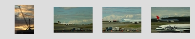
Unlike the other ports we stopped at, Sitka does not have thousand-foot piers to dock cruise ships. There’s a small marina and port facilities to dock, say, 50′ catamarans and fishing trawlers, but that’s about it. Visitors from cruise ships are actually ferried using the ship’s motorized life boats, disembarking the ship from a small floating platform extended from the side of the ship by large hydraulic arms. People in wheelchairs probably wouldn’t be exiting the ship at this port, at least not without difficulty and only for emergencies.

Note that these lifeboats aren’t rickety open-air rowboats (a la Titanic), but fully enclosed motorized launches capable of snugly seating 90 people. In an emergency, the lifeboats can hold 150 plus crew and can probably travel quite a ways under their own power. On the Ryndam, they hang above the round-the-ship promenade, and we walked underneath them almost every day; they’re big boats.

Because the rate of disembarkation from the ship was somewhat limited at this port, passengers interested in visiting the town had to take numbers and wait to be called. We had a shore excursion, so our tender was already scheduled. In fact, we had a morning shore excursion, so we would go off on the first tenders. This turned out to be a good thing, as the tendering queue got backlogged by midday, and a number of people who had numbers weren’t able to get to shore or gave up in frustration, including a couple from our dinner table. (Apparently, the hotel staff didn’t insist that people be ready to immediately disembark when their numbers were called, so passengers hung out in their cabins until the announcement came through, then took their time to get dressed, etc. There was also only one tender disembarkation point from the ship, rather than having two and doubling the capacity (only a fraction of the lifeboats were used for this). People with later shore excursions may have gotten screwed, as their tenders may not have been ready in time.) Sitka was also the shortest stay, with the ship in port for only seven hours, and the last tender to come back from shore scheduled at around 4PM.

We found out later, from the frontpage of a town newspaper, that there were seven cruise ships in port the day before. Ryndam was the only ship there when we were there. I can’t imagine the chaos seven separate tendering operations would have caused, especially given the limited on-shore facilities to receive the tenders. The day before must have looked a little like D-Day with the numerous tenders that would have been in the water, not to mention the boat traffic that comes from day-to-day life in Sitka.

The shore excursion title was slightly wrong: we went to the raptor center before embarking on the sea otter quest. The raptor center is just outside of town. Injured raptors — eagles, hawks, falcons, ravens, owls — are brought to the center for rehabilitation. If the injuries aren’t disabling, they’re treatment aims to bring them back to the wild. If they are crippled, there’s room at the center for them. The center is operated by volunteers from around the country (presumably, there’s a staff veternarian), and, over its history, it has rescued birds numbering into the thousands. The first thing we saw were two large enclosures meant to keep birds safe while keeping them away from the sight and sound of humans; birds in these enclosure are meant for eventual release. At the time, there were three or four eagles and a couple of owls. (No pictures here, as the fine wire mesh and dark glass kept us from getting reasonable shots.) After this stop, we filed into a small lecture hall, where we saw a short video about what the center does. Then, one of the trainers brought in an adolescent bald eagle that was never going to leave the center (injuries to the claws keeps her from effectively hunting).

Bald eagles have up to seven-foot wingspans. They’re huge birds, easy to recognize from a football field away. This one was about fifteen feet away. She was trained not to panic in the presence of large crowds, though we were told not to make much noise, not to stand up, and not to clap. This bird’s destiny was as an ambassador for the center, visiting schools and other lecture halls, to help spread the center’s message. While the trainer was answering questions, he’d feed the eagle scraps of salmon. One person asked why he always looked at his hands after the eagle grabbed the salmon with her beak. Are you checking for injuries? No, it’s to make sure she got all of the salmon. You don’t want to accidentally smear a bit of fish on your shirt or hair.

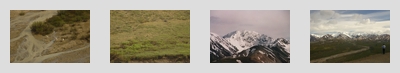
After the lecture, we had some time to wander the center’s grounds. There are large, open-air enclosures housing other eagles, as well as falcons, hawks, owls and so on. The bird from the lecture was returned to her cage near the center’s entrance. After taking pictures, we took the shuttle back to town.

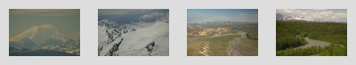
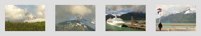
The “sea otter quest” boat was ready to depart when we got back to Sitka’s port. It was a narrow catamaran, with an upper deck for passengers to take in the sights. The trip would basically loop through the bay and head out to various islands where the guides knew there’d be birds. If we saw whales and otters on the way, that’d be great. As with all wildlife tours, there are no guarantees the animals would put in an appearance.

We actually saw more whales on the this tour than some of the whale watching tours, running into two groups of humpbacks. Whales take four or five breathes — visible spouts on the water — before doing on deep and long dives. On the last breath — on making their deep dive — whales would typically raise its tail out of the water, presumably to get the right diving angle. That tail coming up and going under is the money shot for all us amateur photographers on these tours. That giant tail is only out of the water momentarily, and you have to have the camera pointing at the right spot to catch it. (We didn’t see any whales jump out of the water, Free Willy-style, though one did near the cruise ship during breakfast. But we were on the other side of the ship and didn’t get to the windows in time. The oohs-and-aws from the starboard side of the dining room was impressive, though.)

Trying to get these shots was when I wished my cheap memory card was faster, like one of those Lexar Ultra IIs. The D70 can take three shots per second indefinitely if the card is fast enough to accept them. With my pokey cards (basic Viking 1GB CFs: I think they’re rated at 4x as opposed to 80x on the high-end Lexars), I’d get off three shots and then twitch in mild horror as the camera paused to write out the images while the best tail moments were passing by. I’d run into similar issues the next day at the Hubbard Glacier. So, note for the future: any possible wildlife and/or action shots on the big trip requires the more expensive cards. Don’t skimp: you’ve paid thousands of dollars to get there, and saving $50 on cheaper cards ain’t worth it. And, as noted earlier, that extra stop or two on the long lens helped make acceptable shots possible: don’t skimp on the lens, either.

After chasing around whales, the boat took us to an island bird sanctuary. We had seen some birds near the whales, but this island was teeming with puffins, terns and a few bald eagles. We were able to get close enough to the puffins to actually get a shot of one of them taking off: as it left the water, you can see its feet pumping in time to the wings, for that extra bit of oomph to get airborne (this showed up later when we were looking at the pictures; we didn’t see it with the naked eye). The island was beautiful in itself, a big hunk of gnarled rock with trees growing on it. There were starfish — orange ones and purple ones — clinging to the rocks on the surfline.

Then it was off to find sea otters. We can across two groups of them. The first group let us get close enough to take a few distant “yes, those dots are otters” photos before they dove. The second group, or, rather, one individual of the second group, didn’t give a damn and sort of floated on its back, letting us take pictures of him. He’d even do a jack-knife to touch his toes and roll onto his stomach. Otters are apparently one of those mammals that spend their whole lives at sea. They rely only on their fur (instead of oil) to keep warm and waterproof: they adopt their typical “prayer” pose to keep their front paws/hands from getting cold, using a sort of self-grown muff.

The last leg of the trip took us to an inlet with a wide, low waterfall spilling snow melt into the sea. Floating around the hull were large numbers of jellyfish, which apparently are found in all climates. On the way back, we saw an eagle perched on a rock, which was covered with bird droppings. The boat’s crew served a late snack of smoked salmon on crackers. This was arguably the lightest lunch we had on the whole trip.

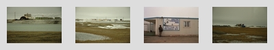
We had an hour before when the last tenders would leave, so we walked around Sitka, which was the prettiest ports we stopped it. The downtown had souvenir shops, but was relatively untouched by tourism. Many of the stores looked like they were meant to serve residents as well as tourists, which was a relief from the massed souvenir bazaars of the other towns. We also saw locals up and about, going about their business. I suppose the lack of big docking facilities and the necessity of tendering keeps the pace slower: tourists come in a relatively trickle, as opposed to being disgorged enmasse on the piers. I don’t know what the town looked like the day before we were there, when there were seven cruise ships in the bay, but the tendering facilities can’t have handled that many people. Perhaps each ship got an allocation of landings that it could make.

St. Michael’s Cathedral is in the town center. It’s a Russian Orthodox church, and part of the heritage of the town: it was founded by Russian fur traders before going over to U.S. control after 1867. (The U.S. bought Alaska for $7.2 million. The $200K was apparently the value of the remainder of a Russian contract to supply ice from Sitka to San Francisco, and was tacked on to the original negotiated price of $7 million.) The sea otter quest group gave us vouchers to visit the cathedral, saving us the admissions fee. It was small, with Orthodox artwork on display. Down the street from the cathedral was the town square, with a large totem pole on the green. A statue of a travelling miner stood in front of the main town building. Within sight of each other, you have symbols of Alaska’s past, from the Tlingits to the Russians to the American miners passing through for the Yukon gold rush. A bit further down the street, past where the road bends at the cathedral, were the modern tourist emporiums near the docks.

The tendering operation back to the ship was much like the one leaving the ship, though we had to wait a few minutes just off the ship’s mooring point, because some of the other tours dropped passengers directly off at the Ryndam instead of taking them to port and making them get on a tender. While waiting, I was chatting with a woman who also had a Nikon D70, a recent purchase for this trip. She had a fancier long lens, one of the newer 70-200mm f/2.8 VR ones, though that was stowed away in one of those Lowepro backpacks. She had gone to Nikon school before the trip to learn how to use the camera. I was mildly jealous, as VR would have helped a lot on the boats.

Dinner was casual or semi-casual (or semi-formal) tonight, with a minor twist. This was towards the end of the cruise, and the ship’s kitchen had a few dessert surprises in store for the passengers. On this penultimate night, there was no dessert menu. Instead, the lights dimmed, and the wait staff marched out with baked alaska platters, all lit by sparklers (white cake, topped with ice cream and meringue). Over on the upper dining room, our fat German executive chef (“never trust a thin chef”) introduced his kitchen staff to happy applause and twirling table napkins.

The next entry is the Hubbard Glacier.

Skagway

June 20th, 2005 | 20:35

The previous entry is Juneau.

June 2

Skagway was where I saw how important that extra stop or two on the 80-200mm f/2.8 lens is worth: when you’re on a pitching boat and want to take shots of wildlife, you really do need a very high shutter speed, especially with a 450mm film-equivalent focal length on the lens/teleconverter combo. We saw seals sunbathing on rocks, dozens of feet away from the boat, which was thick with people trying to get their shots in, all the while bobbing up and down in the waves. Amateur photographers have few luxuries of time and place to work, but at least the envelope in which you might get acceptable shots can be expanded with better equipment. Someone asked me if I could get anything good out of such a big lens on a rocking boat, and I replied, yes, because the lens is fast. I’m not sure how much longer a lens could be used handheld in these conditions, but the 200mm f/2.8 and 1.5x teleconverter plus polarizer is probably close to the limit, and only because of the fast aperture; slower lens aren’t going to work, not without VR to buy you that extra effective stop or two.

Skagway and Glacier Point

We had another morning shore excursion — most of our scheduled excursions were in the morning, so we’d have time to explore the ports before dinner. This day, we would take a fast boat to a short hiking trail, head over to a river and paddle up to the face of a glacier. Basically, we would be doing what we saw from a distance when walking near the Mendenhall Glacier in Juneau, but with even more time spent on water.

There was some worry that I’d get seasick on the boat to the glacier — I had gotten very seasick on a whalewatching trip in Maine some years ago and got a bit sick on the cruise ship itself when it was in open waters south of Ketchikan — but the fast catamaran was fine, sort of line a bumpy subway ride when it was going at speed. It was a relatively short trip, too, about 45 minutes from Skagway, down the Lynn Channel fjord, past Haines, to a beach landing for our trip through the woods. There was a short detour when someone spotted the distant spray from a whale, but it had started its long dive by the time we turned around to the spot and we didn’t have time to wait 20 minutes for it to come back up. We also took the scenic route to see the above mentioned group of seals lounging around on sunny rocks.

On the way down the fjord, our excellent guide gave a lecture on the natural history of glaciers, how retreating glaciers carve out fjords and how the local ecology is dominated by the presence of the glacier: the particularly cold water in the fjord and the 18-hours of daylight blooms dense beds of plankton — the waters in the fjord are almost bright green — which bring the fish, which bring the whales and seals. There are also salmon, which bring the eagles (late in the salmon run, the Lynn Channel has the highest concentration of bald eagles in the world). The retreating glacier also leaves sterile land behind it. You can see forest development progress in from the beach to the foot of the glacier, with the oldest and most developed trees on the shore, and the grasses closest to glacier. There are differents types of trees and shrubs in between, with the shorter shrubs eventually being killed off by the taller trees, which have evolutionarily developed greater height in the competition for sunlight. Along every hill on the fjord is a waterfall, and we hear about the stunning amounts of water that comes through this part of Alaska every year. We learn a little bit of the history Davidson Glacier we’re about to see: it was described by John Muir (it has retreated three miles inland since his visit more than a century ago) and was one of the glaciers in the area that helped him propose his theory that the landscape was carved by glaciers (this would still be in the day that geologists thought the earth was more or less static).

After landing at the Glacier Point beach, we drove inland on modified all-wheel drive school buses to a camp where a team of guides fitted us out with life preservers, watertight boots and extra clothing — the glacial lake could be cold with the wind coming off the ice, and some people had dressed too lightly. The area was swarming with mosquitoes, our first real encounter with the Alaskan state bird. We were told the mosquitoes would be gone by the time we were on the water, as the wind would blow them away. I saw one the size of a quarter lounging on the side of the shack. After gearing up, we hiked a quarter-mile to the river landing where the wide-bottomed canoes were, and were told how to row, how to get out of the canoe without tipping it over, how we weren’t supposed to stand, etc. For some reason, Grace and I got the front seats and were designated “paddle captains”, with the rest of our canoe coordinating their paddling with us. (It was lucky: we got a good view and had a place to safe place to put our bags.) Our canoe guide sat in the back to steer and, later, operate the outboard motor. She would shout out one of three paddling instructions: forward, back and stop. Olympic crew we weren’t.

The canoe paddling was easier than expected, and wasn’t strenuous at all: anyone could do it. We basically paddled for about a mile until we got to the glacial lake, and then the guide turned the motor on: all the better to manuveur given the spots on the lake we were going, and given the more intense wind off the glacier. There were “small” icebergs in the lake, the above-surface portions far bigger than the canoes. An eagle also flew over each of the canoes to see what was going on. With the eagle overhead, a panicked flock of terns took wing from their perches on a gravel hill near the glacier, fleeing the area.

The glacier face was about 80′ high and we got a few hundred feet from it. The guides go to the glacier every day and have a good idea about when it might be calving, but there was no need to get close enough to risk a whole canoe being sunk by falling ice. The size of thing has to be experienced: it’s not well conveyed by mere photos. We headed back down the river after cruising the lake for a while, and it was back to paddles again as we landed the canoes. On the way back, we found out that being tour guides in Alaska was a popular summertime activity for the ski bums who winter in Colorado. It’s good money and the landscape is amazing.

On the catamaran ride back, the guide noted that the whole economy of the region has been transformed with the arrival of Alaskan tourism. Places like Skagway would be ghost towns but for the dollars tourists bring. Similarly, the native economies would be less prosperous. The catamaran we were riding is the fastest around, owned and operated by a Tlingit group. The boat was commissioned a couple of years ago by the tour company, with specifications to service visitors from the cruise ships — it had to be capable of going fast enough to make the trip from Skagway’s docks to Glacier Point in 45-minutes to conform with cruise ship schedules; it had to seat so many people; it had to be able to do a beach landing because that’s all Glacier Point has — and off-season, it would just be a fast ferry around the fjord. Similarly, there were all sorts of native artists supplying crafts to the souvenir shops, in terms of sandstone carvings and small totem poles, as well as more contemporary art. From a personal point of view, our guide had taken the same tour we had a few years ago; it was a life-changing experience that got him to move to Alaska himself. The tourist money keeps him employed at a job he loves; we should all leave good reviews of his tour, and comments on how to improve it.

Skagway itself looks like a stereotypical town out of the Old West, with plank sidewalks, frontier architecture and former saloons (now souvenir shops and cafes) lining the long main street. At the time of the Yukon gold rush, it was the northernmost town that could be reached by ship, and was one of the main transit points for fortune-seekers continuing into inland. A railway up into the interior helped the town survive and continue to be a main transit point, even as the gold rush petered out. (A number of the shore excursions featured historic railroad rides from Skagway to the interior. From our balcony, we saw one of the trains depart before our tour began. The locals guiding passengers aboard wore period frontier costumes to fit the theme.) We walked around there for a bit. (Our tour guide had recommended the smoked salmon made and sold by some friends of his, and we spent some time looking for the shop. We bought some to have as a snack on the bus ride down from Prudhoe Bay, but misplaced it in Anchorage.)

Though there were a few free museum exhibits on Skagway’s past, the center of town is geared entirely to tourism. Skagway was perhaps the densest tourist town we had seen, where everything seems to have been given over to the visitors from the cruise ships. And for some reason (this is true for all the Alaskan tourist towns), there’s a shockingly large number of jewelry stores that sit mostly empty. Someone must be buying expensive jewelry, but I don’t know why you’d do it on a cruise, in a tourist trap. These stores cluster close to each other on the main street, close to the docks, like the strange golden heart of this economy. Around them are the busier souvenier stores, selling everything from t-shirts, gag gifts, tours, Russian nesting dolls, native art work, tins of salmon, Ulu knives and snacks to the crowds that pulse in off the gangways. Money flows in from the wealthier parts of the world, arriving on the cruise ships that may be the metaphorical whales of the modern Alaska, with tourism as the metaphorical whaling tradition.

The next entry is Sitka.